From our news services
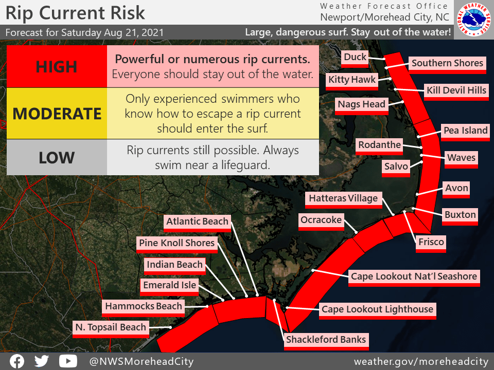
A high surf advisory and a rip current risk is in effect for the beaches of Hatteras and Ocracoke Islands and Core Banks through today, with breaking waves of 6 to 10 feet possible, the National Weather Service out of Newport/Morehead City said today (Aug. 21).
The swells are coming from Tropical Storm Henri which is expected to become a hurricane as it passes well off the coast today.
No rain or high winds are expected on the Outer Banks from this storm, but minor beach erosion and overwash of vulnerable dune structures are possible, especially around high tide this evening.
Farther north, a hurricane warning was issued Friday evening for parts of Long Island and the Connecticut coast. A storm surge warning is also in effect for parts of Long Island, Connecticut and Massachusetts, including Nantucket and Martha’s Vineyard, the National Hurricane Center said. The storm is expected to bring heavy rain and flooding throughout areas of southern New England.
Hurricane Bob was the last hurricane to make landfall in New England 30 years ago. It came ashore in Rhode Island as a Category 2 storm, killing at least 17 people and creating more than $1.5 billion worth of damage.
Bob left streets in coastal towns littered with boats blown free of their moorings, knocked out power and water to hundreds of thousands for days.