Home Blog Page 440

It’s best to call professionals for stranded beach birds

0


Pelican in surf
A pelican entangled in fishing line is caught in the surf.

By Connie Leinbach

Fall begins another fishing season, and that means beach-goers may see birds entangled in fishing line.

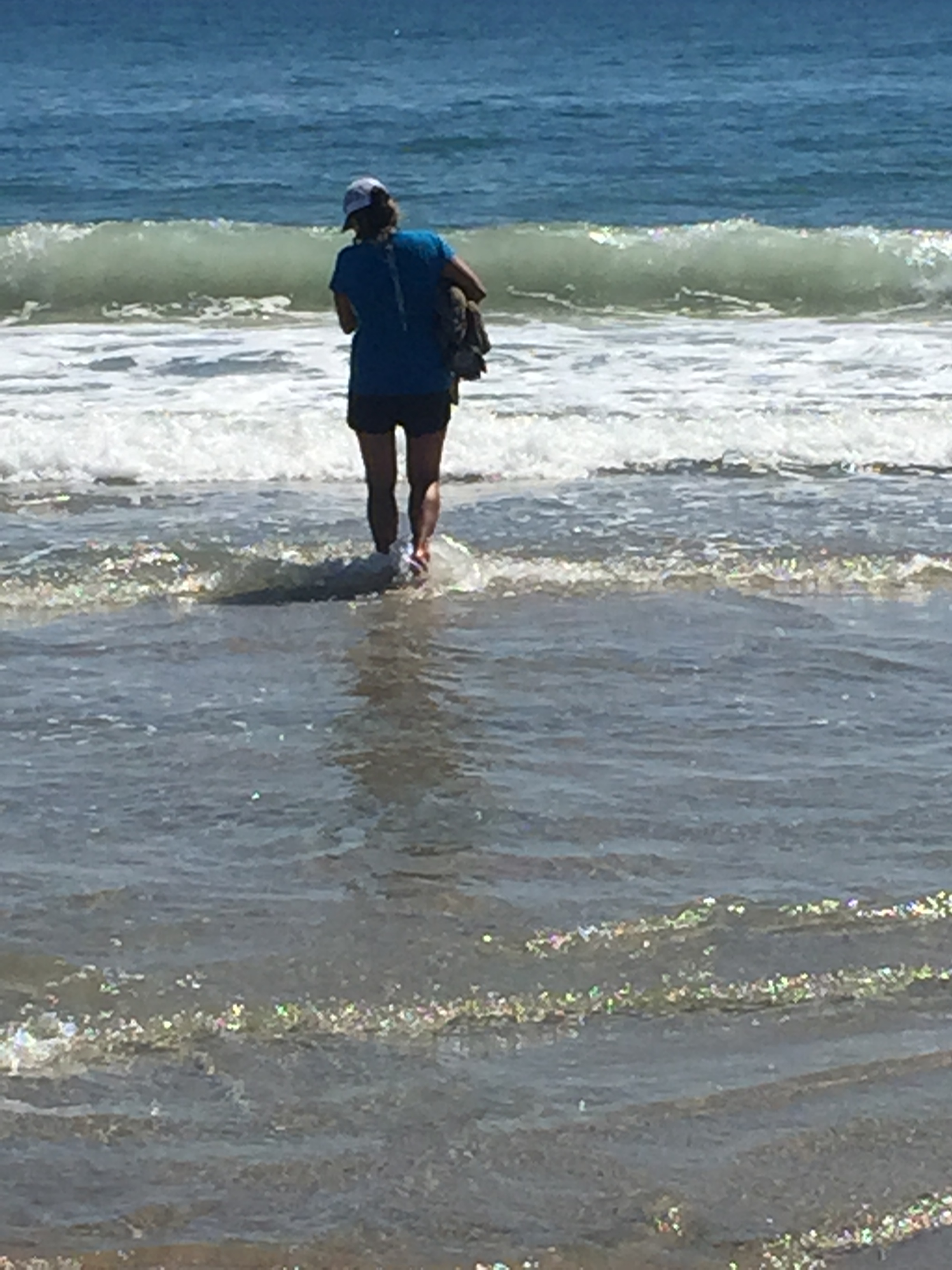
Cheryl and Ron Mangus of Green, Ohio, learned this on Sept. 15 when they were on the beach and noticed a pelican thrashing in the surf.

As the bird tried to go back into the water, she noticed the fishing line entangling it.

“I said, ‘Hey. We gotta help this guy,’” she said about the encounter. “It was starting to drown.”

Another beach-goer, part-time islander Sarah Searight joined the couple and all got the bird out of the water.

Sarah Searight with pelican
Sarah Searight with the untangled pelican.

“Sarah grabbed ahold of its beak,” Cheryl said, and the group began cutting fishing line.  “That pelican knew we were going to help it. It was tired.”

Cheryl said the group was dismayed when an unidentified Park Service employee arrived and told them not to do anything for the bird and to just leave it alone.

Park spokesperson Cyndy Holda said that currently the majority of park staff would offer the solution of calling either a local wildlife rehabilitator or local vet for assistance.

“The vast majority of park employees would go the next step in offering a solution,” Holda said.

Ed Fuller, Ocracoke’s chief ranger, said in an interview afterwards that there’s no policy banning people from helping birds, and that beach-goers are free to call either his office at 252-928-5111, or Ocracoke’s wildlife rehabilitator Elizabeth Hanrahan at 252-928-2604. 

“We call Elizabeth if there’s an injured bird,” he said.

That’s because of the danger of interacting with wildlife who might take swipes at good Samaritans.

“It’s fine if people want to help,” Hanrahan said, “but some of those birds are vicious.”

Both pelicans and cormorants have hooked beaks and she suggested that people helping birds first throw a towel over their head so that they can’t see you.

“A cormorant will go for your eyes,” she said.

Common loon on Ocracoke beach. Photo by P. Vankevich

Peter Vankevich, an island birder, also noted that injured loons do not take kindly to human help and should not be approached.

“They are very dangerous,” he said and should not be approached except by a professional.

“The great blue heron’s bill is like a knife,” Holda added. To walk up to a wild animal that is injured is dicey, she said.

Hanrahan said she gets calls about birds caught in fishing line at least once a week.

 “People need to be careful of their fishing line and take it back out of the water,” Hanrahan noted.

Fishing line can be recycled at Tradewinds and at two deposit pipes at the NPS public dock areas.

Injured or dead sea turtles on CHNS beaches are strictly the Park Service’s bailiwick, and because they are threatened or endangered, the park service should be notified as soon as possible.

Searight releases the pelican.

Joaquin forces Seashore closures

0
This closure at Ramp 72 last Saturday will be repeated on Friday when the NPS closes beach access ramps in anticipation of Hurricane Joaquin.
This closure at Ramp 70 last Saturday will be repeated tomorrow when the NPS closes beach access ramps by 5 p.m. in anticipation of Hurricane Joaquin.

Oct. 1, 2015

Manteo–In anticipation of the impending hurricane, The Outer Banks Group National Parks, Cape Hatteras National Seashore, began closing facilities today:

All NPS campgrounds, Ocracoke, Frisco, Cape Point and Oregon Inlet began closing at noon today and remain closed until further notice.  The Ocracoke Recreation.gov campground reservation system has been temporarily suspended.

Silver Lake Marina NPS rented docks began closing at noon

Ocracoke, Hatteras Island and Bodie Island NPS Visitor Centers began closing at noon today and will remain closed until further notice.

All park specially scheduled programs have been cancelled until further notice.

All NPS beaches will be closed to off-road vehicles by 5 p.m. on Friday and remain closed until further notice.

The Buxton, Ocracoke, and Bodie Island Off-Road Vehicle Permit offices closed at noon today.

NCDOT Ferry Division implements Ocracoke evacuation procedures

0
Evening ride on the Swan Quarter ferry.
Evening ride Wednesday on the Swan Quarter ferry.

Oct. 1; 4  p.m.

In accordance with Hyde County’s mandatory evacuation order issued earlier today, the North Carolina Department of Transportation’s Ferry Division will be implementing its procedures for the evacuation of Ocracoke Island that began at 3 p.m. today.

Those procedures include:

  • No tolls on Pamlico Sound routes
  • Reservations cancelled on Pamlico Sound routes
  • No priority loading on Ocracoke-Hatteras route
  • No visitors allowed on ferries headed to Ocracoke
  • Residents, property owners and vendors allowed on Ocracoke-bound ferries THURSDAY & FRIDAY ONLY

The Hatteras-Ocracoke route will be running its regular schedule until evacuation is complete:

Departing Ocracoke: 5 a.m., 6:10, 7:25, 8:30, 9:45, 10:10, 10:25, 10:50,11:10, 11:55, 12:05 p.m., 12:30, 12:45, 1:10, 1:30, 2:15, 2:25, 2:50, 3:05, 3:30,3:50, 4:35, 4:45, 5:10, 5:25, 6:10, 6:45, 6:55, 7:30, 7:45, 8:00, 8:30, 9:15, 9:30,10:30, Midnight.

Departing Hatteras (residents, property owners, & vendors ONLY): 5 a.m., 6:15, 7:20, 8:35, 9, 9:15, 9:40, 10, 10:45, 10:55, 11:20, 11:35, Noon,12:20 p.m., 1:05, 1:15, 1:40, 1:55, 2:20, 2:40, 3:25, 3:35, 4, 4:15, 5, 5:30, 5:45,6:20, 6:35, 6:45, 7:20, 8:05, 8:15, 9:15, 10:45, Midnight.

Pamlico Sound routes will run the following schedule during the evacuation:

Today (Thursday, Oct. 1):
Ocracoke to Swan Quarter: 6 p.m.
Ocracoke to Cedar Island: 4 p.m.
Swan Quarter to Ocracoke (Residents, Property Owners, & Vendors ONLY):4:30 p.m.
Cedar Island to Ocracoke (Residents, Property Owners & Vendors ONLY): 4 p.m.

Friday, Oct. 2:
Ocracoke to Swan Quarter: 7 a.m, 9:30, 12:45 p.m, 4.
Ocracoke to Cedar Island: 7:30 a.m., 10, 1 p.m., 4.
Swan Quarter to Ocracoke (Residents, Property Owners, & Vendors ONLY): 7 a.m., 10, 1 p.m, 4:30 p.m.
Cedar Island to Ocracoke (Residents, Property Owners, & Vendors ONLY): 7 a.m, 10, 1 p.m, 4.

Saturday, Oct. 3:
Ocracoke to Swan Quarter: 7 a.m., 9:30, 10.
Ocracoke to Cedar Island: 7:30 a.m.
Swan Quarter to Ocracoke (No inbound traffic allowed): 7 a.m.
Cedar Island to Ocracoke (No inbound traffic allowed): 7 a.m, 10.

All schedules are subject to change or cancellation due to tide, wind and other weather conditions. The Ferry Division strongly encourages Ocracoke residents to evacuate as soon as possible, as conditions may deteriorate faster than forecast.

After evacuation procedures are complete, the Ferry Division will moor all of its vessels in safe harbor.

Following the storm, reentry requirements will be established by Hyde and Dare counties and enforced by local and state law enforcement agencies stationed at ferry terminals.

The Ferry Division is also prepared to establish its emergency route between Stumpy Point and Rodanthe in the event of a Highway 12 breach on Hatteras Island.

State of Emergency and mandatory evacuation declared for Ocracoke Island, updated storm forecast

4
Hyde County officials meet via teleconferencing equipment.meeting today in the Ocracoke School commons room.

3:35 p.m.

The Hyde County Board of Commissioners voted today to declare a state of emergency for the county and a mandatory evacuation for Ocracoke Island effective at 3 p.m.

With the mandatory evacuation, visitors will no long be able to travel to Ocracoke. Law enforcement will be stationed at each ferry terminal to allow only residents, property-owners, and vendors access to Ocracoke for Thursday and Friday. No inbound traffic will be allowed starting Saturday.

 Under a mandatory evacuation all ferry routes serving Ocracoke will be on a first-come, first-serve basis. Reservations and priority status will not be honored. Tolls on the sound class ferries will also be temporarily removed.

 The NC Ferry Division has expressed serious concern for rising water levels in the Pamlico Sound. If the water level continues to rise, the Hatteras-Ocracoke ferries may not be able to utilize the loading docks. Therefore, it is imperative that people who choose to leave Ocracoke do so as soon as possible. Property owners and vendors entering Ocracoke today or tomorrow must realize there is a possibility they may not be able to get off the island via Hatteras. 

Anyone who chooses to stay on Ocracoke for Hurricane Joaquin, does so at their own risk and should be prepared to sustain themselves for several days in the event of flooding, downed trees, and/or loss of power.

An emergency general population shelter will be ready to receive residents starting at 6 p.m. tonight in the Englewood Baptist Church, 1350 South Winstead Ave., Rocky Mount, Nash County. The shelter will have showers and food available. Space for pets will be provided. Please be prepared with clothes, medication, and other necessities for several days.

Any patients with advanced medical needs requiring special assistance should contact the Hyde County Health Department at (252) 926-4200.

Ocracoke School closed early for a half day today and does not expect to reopen until Tuesday or Wednesday, according to Walter Padgett, principal.

Ocracoke United Methodist Church will be closed on Sunday.

Storm information from the Island Free Press (www.islandfreepress.org), reports the following regarding Joaquin:

After seeing most afternoon global and hurricane models, there remains a wide spread of solutions, but seems to be an overall trend of keeping the hurricane offshore, possibly well offshore. There remains a clustering of land falling hurricane models along with the Canadian and Navy Nogaps global models with GFS/UKMET and ECMWF remaining well offshore.

It is too early for a stand down, but it seems the threat is considerably less than this time yesterday.

Onshore near gale force winds will continue into the mid-Atlantic coast for the next three days with associated heavy seas/surf/high tides and beach erosion.

This will be exacerbated by heavy swells from a forecast category 4 Joaquin in the Bahamas coming north but off shore and slowly coming down to a cat 1 to 2 as it passes by the mid Atlantic coast late this weekend or early next week.

Heavy seas on Ocracoke Beach.
Stormy Ocracoke beach.

Emergency meeting to discuss Hurricane Joaquin changed to noon

0

Hyde seal

Thursday, October 1, 2015 – 11:00 a.m.
Hyde County Board of Commissioners
Emergency Meeting

The Hyde County Board of Commissioners will meet on today, October 1, 2015 at 12:00 NOON in the Hyde County Government Center, Multi-Use Room and at the Ocracoke Island School Commons Room using electronic conferencing equipment.

The purpose of this meeting is to prepare for Hurricane Joaquin.


Hurricane Joaquin Advisory No. 1 and more from experts

1
NOAA Joaquin forecast as of Wednesday evening.

By Peter Vankevich and Connie Leinbach

For Ocracokers, it is time to start taking this hurricane seriously.

The island is saturated, and this could add to the loss of trees as well as cause more flooded land and road blockages. Additionally, be prepared that the ferry system will shut down once conditions become dangerous.

The first advisory has  now been  issued.

Hyde County Monitoring Hurricane Joaquin;
Preparing to Make Emergency Declaration Decision
 
Hyde County officials are monitoring Hurricane Joaquin in terms of its potential impact to Ocracoke Island and mainland Hyde County. Based on the 2 p.m. advisory from the National Hurricane Center, tropical storm force winds are expected to start impacting Ocracoke Island on Sunday, Oct. 4.
Joaquin is also likely to result in high seas, several inches of rain, flooding and strong winds.
In consideration of the recent heavy rain and minor flooding, Hyde County officials will allow extra time for any emergency actions.
An emergency meeting of the Hyde County Board of Commissioners is scheduled for at 5 p.m. Thursday, Oct. 1, to discuss preparations for Hurricane Joaquin. The public should start preparing now for the storm and be ready to take decisive action if emergency declarations are made.

The National Hurricane Center of the National Weather Service clarifies the difference between a warning and a watch.

A warning is issued when a hazardous weather or hydrologic event is occurring, is imminent, or has a very high probability of occurring. A warning is used for conditions posing a threat to life or property.

A watch is used when the risk of a hazardous weather or hydrologic event has increased significantly, but its occurrence, location, and/or timing is still uncertain. It is intended to provide enough lead time so that those who need to set their plans in motion can do so.

 On the Weather Underground website, Jeff Masters and Bob Hanson are voicing conerns that this major storm could strike Ocracoke or very close by.

Hurricane Joaquin Forecast Discussion

HURRICANE JOAQUIN DISCUSSION NUMBER 12 NWS NATIONAL HURRICANE CENTER MIAMI FL AL1120155 PM EDT WED SEP 30, 2015

There has been little change in the organization of Joaquin during the past several hours. While the hurricane continues to produce cloud tops colder than -80C in the eyewall, the eye has not become better defined since the last advisory. Satellite intensity estimates are 77 kt from both TAFB and SAB, so the advisory intensity is now 75 kt. The initial motion is 225/7.

The shortwave ridge causing this motion is expected to weaken during the next 24-48 hours as a strong deep-layer trough develops over the southeastern United States. Thus, a generally southwestward motion is expected for the next 36 hours or so, followed by a turn toward the north as the trough becomes the dominant steering mechanism.

There is an increased disagreement between the GFS, UKMET, Canadian, and NAVGEM models versus the ECMWF since the last advisory. The ECMWF has continued its forecast of showing a northeastward motion after 72 hours, taking Joaquin just west of Bermuda and out to sea.

The other models have all shifted their forecasts to the left and now call for landfall in the Carolinas and the mid-Atlantic states, followed by merger with the baroclinic trough. Given the shift in the non-ECMWF models, a major westward adjustment has been made to the forecast track at 96 and 120 hours, bringing the center of Joaquin near or over portions of the mid-Atlantic states.

Due to the use of the ECMWF in the consensus models, the new track lies near the various consensus models. However, it lies well to the east of the GFS and the other similar models. The NOAA G-IV jet is currently flying a synoptic surveillance mission, which, along with special rawinsonde launches, hopefully will reduce the spread of the guidance. There is little change to the intensity forecast philosophy since the last advisory.

Joaquin is expected to remain in an environment of moderate northeasterly vertical shear for the next 24-36 hours, possibly including strong winds seen at 400 mb in recent dropsondes from the G-IV aircraft. However, since it has been steadily strengthening in such an environment, there is no obvious reason to think it will stop doing so. After 36 hours, the hurricane is likely to move into an area of divergent southerly upper-level winds associated with the eastern U. S. trough. While there is uncertainty as to how much shear should occur, it is expected that additional intensification could occur through at least 48 hours.

Based on this, the intensity forecast calls for Joaquin to peak as a major hurricane in 48-72 hours, and it is possible it could be stronger than currently forecast. After 72 hours, increasing shear, cold air intrusion, and land interaction should cause weakening and the start of extratropical transition.

KEY MESSAGES: 1. Preparations to protect life and property within the warning areas in the Bahamas should be rushed to completion. 2. A significant adjustment to the forecast has been made this afternoon, and this shows an increased threat to the mid-Atlantic states and the Carolinas. However, confidence in the details of the forecast after 72 hours remains low, since we have one normally excellent model that keeps Joaquin far away from the United States east coast. The range of possible outcomes is still large, and includes the possibility of a major hurricane landfall in the Carolinas. 3.

Every effort is being made to provide the forecast models with as much data as possible. The NOAA G-IV jet has begun a series of missions in the storm environment, and the National Weather Service is launching extra balloon soundings. 4. Because landfall, if it occurs, is still more than three days away, it is too early to talk about specific wind, rain, or surge impacts from Joaquin in the United States. Even if Joaquin stays well out to sea, strong onshore winds will create minor to moderate coastal flooding along the coasts of the mid-Atlantic and northeastern states through the weekend. 5.

A hurricane watch for a portion of the U.S. coast could be required as early as Thursday evening. 6. Many areas of the eastern U.S. are currently experiencing heavy rains and gusty winds associated with a frontal system. This inclement weather is expected to continue over the next few days, which could complicate preparations for Joaquin should it head toward the coast, and greatly exacerbate the impacts from the hurricane.

Heavy rains are likely to continue over these areas even if the center of Joaquin stays out to sea.


Hyde County Board of Commissioners emergency meeting tomorrow: 5 p.m. at Ocracoke School

0
Hyde seal
Hyde County Board of Commissioners
Emergency Meeting
 
The Hyde County Board of Commissioners will meet on Oct. 1, at 5 p.m.in the Hyde County Government Center, Multi-Use Room and in the Ocracoke Island School Commons Room using electronic conferencing equipment.
 
The purpose of this meeting is to prepare for Hurricane Joaquin.


October is the month for fishing on Ocracoke

0
WHAT A CATCH! Wahoo, drum, mahi mahi. Photo courtesy of the Gecko Sportfishing.

October is best the month for surf fishing on the island, according to Alan Sutton at Tradewinds Tackle Shop.

“Anything you can catch at the beach will be out there,” he said.

That’s because as the Pamlico Sound starts to get colder, the fish migrate out to sea for their food.

“They want to get fat and happy before they move south,” he said.

So, the waters are ripe for big drum, little drum, flounder, sea mullet, black fish and more

Sutton said drum especially are good game in the fall because the rough water churns up their food supply.

“In the surf, to catch drum the water should be rough enough to use a 6-ounce weight,” he said.

Drum like choppy, “shoaly” water.

“Guys on their boats will go up on the shoals (to catch drum),” he said. “When the water is calm and pretty, it’s not necessarily the best fishing.”

Drum of up to 40 inches is the size limit and drum at 40 inches and above will merit a citation (certificate of achievement) but they must be released, he said.

These big ones are older fish, while the smaller ones are called puppy drum.

Offshore, there will be good wahoo, black fin and yellow fin tuna, trigger fish and vermillion snapper, which are bottom feeders, said Ernie Doshier of the Gecko Sportfishing.

Tropical Storm Joaquin is brewing in the Caribbean

2
Possible track of Joaquin
Possible track of Tropical Storm Joaquin

From Dare County Emergency Management

TD11 has become Tropical Storm Joaquin. Current forecast track is depicted in the above image.  The National Hurricane Center (NHC) indicates confidence in the details of that track forecast–especially beyond 48 hours–is extremely low.

Environmental conditions are making intensity forecasting a challenge as well.

The NHC indicates “there is a lot of spread in the intensity guidance as well” and with the uncertainty in Joaquin’s structure and track, they state the 5 a.m.forecast “remains conservative.”

That conservative forecast has TS Joaquin turning to the north early Thursday morning and then tracking off our coast as a tropical storm later this week into the weekend. At this time we should anticipate high surf conditions to continue for the near term along with other weather impacts like heavy rain and gusting winds that will come with a storm tracking off the coast.

If you need additional info please visit the Hurricane Center here for what Joaquin is doing and our local National Weather Service office for the local impacts.

Bill and Jim’s excellent adventure

0
Bill Monticone and Jim Borland on their summer kayaking trip.

Kayaking in the Pacific Northwest

By Jim Borland
Photos by David Gillispie

Even in summer months, cool weather is the normal fare for the west coast of Vancouver Island, British Columbia. 

So as my good friend and kayak companion islander Bill Monticone and I arrived in the last part of July for a week-long ocean kayak expedition to the remote and wild Brooks Peninsula, we were somewhat surprised to find drought and hot weather. 

Even so, we enjoyed the cooler temps in comparison to our hot and humid Ocracoke weather.

Our group included Dave and Beth, both entomologists (bug specialists) who were celebrating their 40th wedding anniversary with this challenging trip, as well as Paul, an architect from Vancouver, and Masio, an English professor.

Before kayaking, we motored across the hundred miles of Vancouver Island, bisected by a substantial mountain range, until we reached the western coast of the small First Nation village of Kyoquot.          

Then we headed for our West Coast Expeditions base camp at Spring Island. 

In an exploratory paddle, the guides evaluated our kayaking strengths and weaknesses.   This was my first encounter with the Pacific Ocean, and it was sobering. The enormous power of the swells makes our East Coast look meek and mild.

The view from one of the camps.

A family of nine wolves was living just outside the camp, which is almost unprecedented as normally wolves avoid people.  For some unknown reason, they had been coexisting for several months on the island.

Later that night, we were awakened by the wolves howling–an eerie, but pleasant sound.

With a fair weather forecast the next morning, we paddled an arduous, 15-plus miles to the un-glaciered and unlogged Brooks Peninsula and our next campsite.

Most of these small islands were littered with 20- to-40 foot logs. The beautiful and huge trees were mostly western cedar, Douglas fir and hemlock, with a smattering of spruce.  The Pacific lapped lazily at the shoreline.

Before dinner that night, a black bear emerged from the woods down the beach from us and began meandering our way.

As directed by Sarah, one of our two guides, we began shouting, “Go away, bear!” It finally went back into the woods.

The next day we had an easier day paddling, maybe nine miles, to Brooks Peninsula, a large swath of land owned by a local First Nation.

Virtually untouched by the last ice age, it harbors many ancient species of plants, and, being unlogged, some of the oldest trees on the planet.

We pulled up to a long, stony beach lined with magnificent old growth trees, many so big we couldn’t see the tops.  We pitched our tents under those 1,000-year-old giants.

Our next day consisted of a strenuous hike over heavily wooded terrain and huge black, volcanic rocks.

Sorry to leave Brooks Peninsula, we headed out on day three as soon as the tide allowed.

The tides in that area of the country are impressive, sometimes 50 to 75 feet laterally.

That day, we headed for the mainland about nine miles away. As we skirted the coast, we saw numerous bald eagles, some sea otters and seals.

Soon after a long haul and some choppy swells, we came to a calm sandy beach. We had been paddling hard and were hot and tired.

So into the 50-degree water we went.

Day four we were off to The Bunsbys, a series of islands about half way between Spring Island and The Brooks Peninsula. 

Green Head Rock in the Bunsbys.

Our first stop was at a First Nation fish weir, which is a fence-like sluice created in the water to catch fish.

The First Nation people of the area drive fish into the weir by beating the waters with their paddles. They herd the fish in and by closing the opening, they manage to trap large schools of fish.

Then the women and other members of the band scoop the fish into cedar bags and other containers to be cleaned and dried on the beach.

It was almost magical to be there and see their historical way of harvesting so many fish. 

Before we paddled to our last campsite–a small island in the Bunsbys–we visited “green head,” a local rock outcropping with a huge head of trees on its top. It reminded us of a totem.

The last day on the water, we had to find the right beach–not too steep, and with decent, but not dangerous, surf. After some exploring we came upon a good candidate.

Sarah gave us specific instructions about landing by riding right behind the crest of the wave. If done correctly, you floated nicely onto the beach. 

After a short break, we headed back out to sea, but in a different process: catching the wave at the right time so it would carry us out and over the surf.

What a rush. Scary, but exciting. 

Our next challenge was a sea cave–an opening created by eons of heavy surf.

The cave was cool and dark, but had enough light to allow us to paddle. Finally we turned into an opening, saw light and made our way out. Wow! It felt great.

Afterwards, we headed home through some good chop until we saw our final landing at Spring Island. We headed in for the last time.

One of the camps.
One of the camps.

The next morning, the adventure continued as we awakened to the sound of the wolves again.

The whole family was on the tidal flats right outside our tents.

We ran outside with cameras and binoculars and saw two adult wolves with at least six pups foraging and frolicking on the flats. 

What a spectacular end after almost 55 miles on the water.